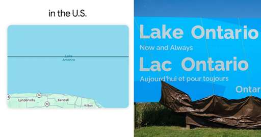
People using the application will see the new name in U.S., but will see Lake Ontario in Canada. Outside of North America, users will see both names for the lake.
CoMaps is pretty cool, but it needs better public transit support. It’s good for driving, but doesn’t have bus schedules where I live like Google and Apple maps do.
Is it an issue where OpenStreetMaps doesnt have your public transit system’s schedule? if I recall, public transit should be something OSM supports. Or is it an issue with CoMaps/OrganicMaps not being able to read that information?
I feel like this is something that can be resolved somewhat easily once the issue is identified.


CoMaps is pretty cool, but it needs better public transit support. It’s good for driving, but doesn’t have bus schedules where I live like Google and Apple maps do.
Is it an issue where OpenStreetMaps doesnt have your public transit system’s schedule? if I recall, public transit should be something OSM supports. Or is it an issue with CoMaps/OrganicMaps not being able to read that information?
I feel like this is something that can be resolved somewhat easily once the issue is identified.